WHERE TO RUN
IN LIMA
Your guide to the best places to run in Lima
6th Aug 2024 (Updated 18th Feb 2025) | 12-min read
I’ve broken down where to run in Lima by the areas and parks that I know. You should find that these are some of the best places to run in Lima. A little heads up: the best place to run in Lima is, without doubt, along the Malecón.
Wherever you end up, enjoy running around Lima!Malecón de Miraflores
Before we get started, I should say that I do not think Lima, on the whole, is a great place to go running. With all its loud and chaotic traffic, it’s not a great place for pedestrians, full stop. However, the malecón is an exception and is rightly the best and most popular place to run in Lima. In fact, for me, the malecón as a standalone feature of a city must be up there with anything that any city around the world could offer.
But putting running to the side for one moment, let me just introduce the malecón:
What is the malecón? What does malecón mean?
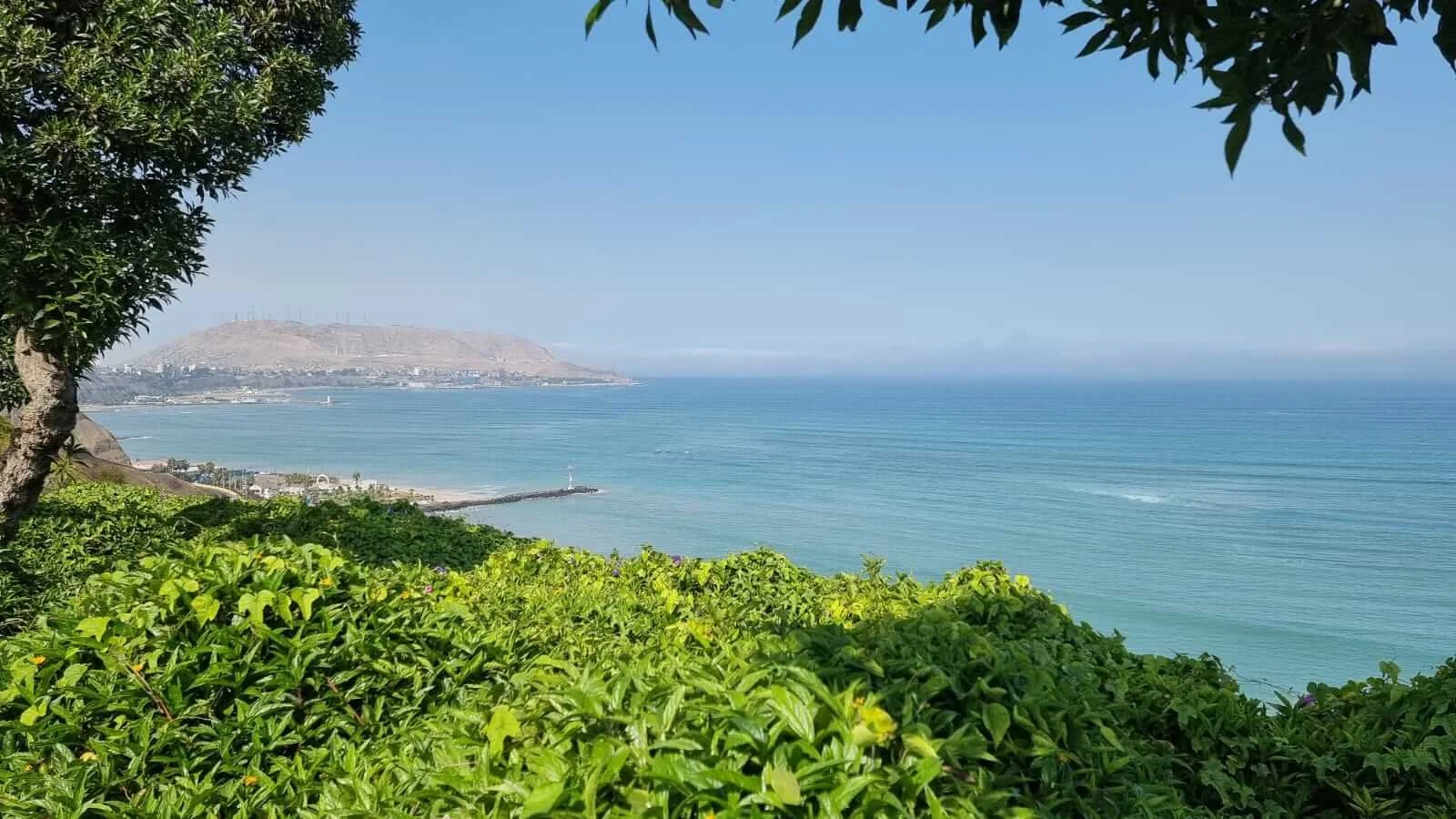
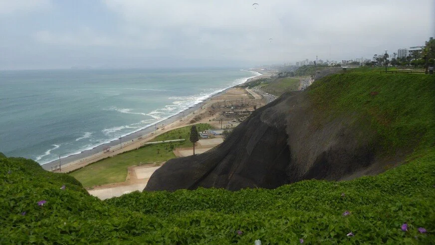
Malecón might be translated as “pier” or “boardwalk,” but the malecón in Lima is an esplanade that hugs the clifftop overlooking the Pacific. (Let’s just call it a walkway!) The malecón is not merely a walkway but more a series of interconnected parks adorned with flowerbeds, sculptures, cafés, viewpoints and places to exercise.
It is rightly a premier attraction in Lima.
Where is the malecón in Lima?
The full name is El Malecón de Miraflores so the malecón is in … yes, Miraflores.
As someone new to Lima, your first introduction to the malecón could be the stretch that forms a triangle with Avenida José Pardo and Avenida José Larco. Here you will find many parks and grassy areas, as well as iconic landmarks such as the ultimate sculpture for lovers, El Beso (The Kiss), and the Faro de la Marina (an active lighthouse).
The malecón is actually divided into three zones:
Malecón de la Marina
The northern section: Estadio Manuel Bonilla to Parque Miguel Grau
Malecón de Cisneros
The central section: Parque Grau to Puente Villena
Malecón de la Reserva
The southern section: Puente Villena to Bajada Armendaríz
So, from north to south, the malecón runs from Estadio Manuel Bonilla (where San Isidro meets Miraflores) to Bajada Armendaríz (the road that divides Miraflores and Barranco).
How long is the malecón?
The malecón spans about 3.1 miles (5 km).
Coastal walkways, however, extend beyond these three listed zones, and that’s why you’ll see conflicting distances about the length of the malecón. You can, therefore, comfortably add mileage to your run whilst still running along the malecón.
In my eyes, a more accurate reflection of the malecón would be to say that it also passes through the districts of San Isidro and Barranco.*
*They are actually building a pedestrian bridge to connect Miraflores and Barranco, which will save you over half a mile if you’re running between the two districts. Estimated completion date: June 2025.
Why the malecón is the best running location in Lima
The malecón is a natural running location in Lima, and there is a reason why you will see so many runners there or why it’s the obvious destination to meet for a run. Take away the carefully manicured parks and footpaths, and you could run there simply to take in the stunning ocean views from the cliffside setting. You really can feel connected with nature, which, as someone who grew up running in the countryside, is important when I’m living in a city. Lima is a very noisy city (you already know how local drivers have their hands glued to their horns), so the malecón offers you welcome respite and space from the more chaotic side of the city.
The breathtaking ocean views are heightened during the summer months, particularly when the sun is setting, but I personally prefer to sit down and properly appreciate the sunsets rather than run at that time. Summer sunsets are, as you would expect, a busy time on the malecón, so factor that in as footpaths will be more crowded. This time of the day will be cooler to run in; however, your best bet to avoid the summer heat is to run in the mornings or, better yet, early in the mornings.
What’s more, given its prime location in Lima, it’s likely you won’t have to run very far to reach the malecón if you are staying or living in the most popular places with expats and foreigners.
Runnling along the Malecón de la Marina towards Parque Grau
Costa Verde
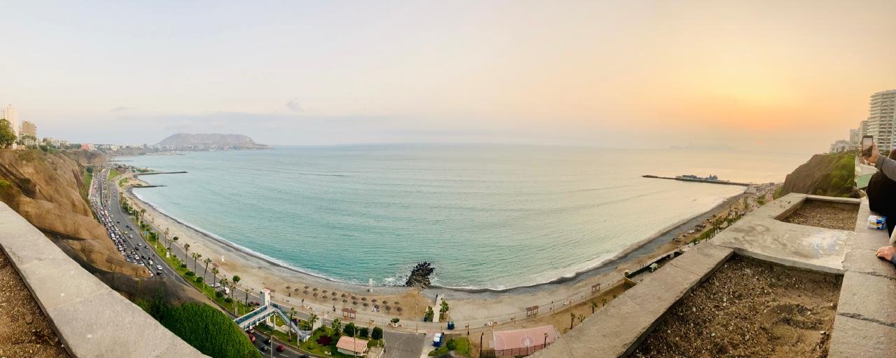
The Costa Verde refers to the coast and the beaches along the bottom of Lima’s cliffs. Going by its name, you would be forgiven for thinking that Costa Verde must be an idyllic part of the city for running. The reality, however, is somewhat different. Despite its seaside location, it’s not as pleasant as you might think. This is primarily due to the fact that you are often running right alongside a busy highway. You can also feel quite isolated in some stretches - if that is a safety concern for you - but there is lots of action along the surfing beaches of Miraflores and Barranco. In case you were wondering, the majority of the beaches are far too rocky to run along. However, you are still running on top of the crashing waves of the Pacific Ocean, with the potential for stunning sunsets, so it can be very picturesque.
The busy highway is called the Circuito de Playas de la Costa Verde and it stretches for around 12.5 miles (20 km). Through a combination of footpaths and bike paths, you could run the whole length of the Costa Verde from Chorillos to Callao, but you might find yourself a bit of a target on the northern section as you approach Callao, depending on the time of day.
Costa Verde is a good running option if you want to mix up your malecón running route or you want to be able to properly stretch out your legs (there can be a lot of foot traffic and twists and turns along the malecón particularly if you run through the parks). Save your energy, as getting back up to the city requires a very steep and leg-sapping climb, either by steps or by road.
Morro Solar
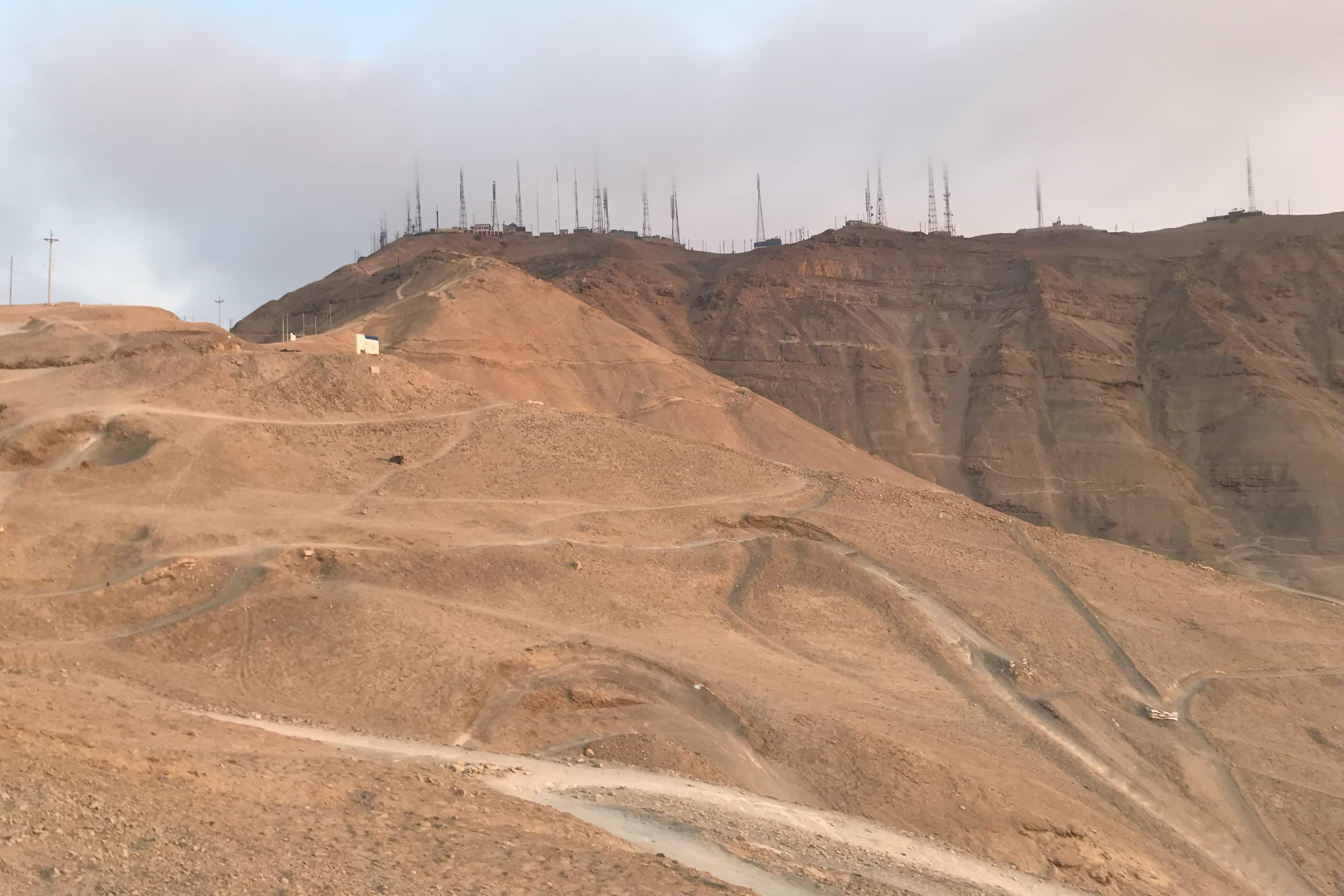
Morro Solar is in Chorrillos, which may not be the most accessible of places, depending on where you are, but if you want to add some hill training and get off-road, definitely consider running up and around Morro Solar. In the summer months, you will have seen Morro Solar and the cluster of hills from the malecón without realising - they are the hills right above the sea to the south of the city. You can’t miss the illuminated cross at night.
What running routes can you do around Morro Solar?
Morro Solar is not your classic urban running route - it is for the more adventurous runner who perhaps longs for the country.
You will need to run uphill, and for a shortened climb, run 1¼ miles/2km up the paved road from Avenida Malecón Grau as it winds its way around the hill to the cross (Cruz del Papa/Cruz del Morro Solar) and accompanying viewpoint across the city. Along the way, you will pass the Cristo de Pacífico, the Monumento al Soldado Desconocido and a planetarium. There is also a direct and much shorter way if you take the steps straight up to the cross just after the first bend of the climb.
As the road begins to level out - after the Monument to the Unknown Soldier - you could run off-road along some trails to arrive at the cross via an alternative route.
To create a bit of a loop, you could head back to the Christ statue and descend the other side of the hill via more trails. The trails are easy to follow since so many mountain bikers descend this way too. Watch your step, as there are lots of loose rocks about, and it can get rather steep.
You could aim for the tunnel and then follow the road back along a more raw and rugged part of the city coastline for 1 mile (1.6 km) back to Avenida Malecón Grau, and where you first turned off to climb the hill.
For an even more strenuous workout, run past the Christ statue and continue up along a dirt track - or via the bike tracks - to the very top of Morro Solar. From the turnoff on Avenida Malecón Grau to the top, it should be about 2-3 miles (3.2-4 km), depending on how direct a route you take. Exercise caution, as these trails could be populated with downhill bikers.
Morro Solar is 823ft (251 m) in height.
Is it safe to run around Morro Solar?
Be more aware of your surroundings than you would be running through Miraflores, but I don’t think you need to see Morro Solar as somewhere dangerous. That said, it is much more isolated compared to other parts of the city and borders poorer communities. So, you should aim to be down before sunset and not be the last one up there. That was the local advice I was given.
Morro Solar is a very popular climb and descent with mountain bikers (in the mornings at least), and there should also be plenty of people driving up or walking up via the steps to the cross. The same can be said for the Herradura side of Morro Solar, i.e. the coastal side, if you intend to come down this side. That was my experience in the summer.
Which are the best parks in Lima to run in?
As soon as you get outside of the city, you get reminded that Lima is in a desert. As a result, it is no surprise that Lima does not have an abundance of parks, or at least not the large, green, leafy ones you might be used to in your own country.
That said, here are some Lima parks you might want to incorporate into your runs.
Parque El Olivar, San Isidro
San Isidro is full of little parks that, while open to the public, are more like private parks for the residential buildings that surround them, especially as many close to the public after 7pm.
Parque El Olivar is an exception, and not just because it doesn’t close. It is much larger and has the feel of a big city park you may be familiar with. It is still not such a big park to run around at only 1km x 250m but is considerably bigger than the majority of parks in Lima.
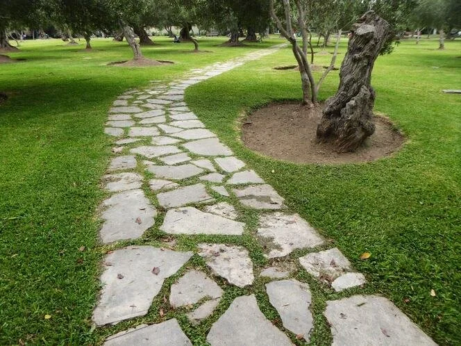
Parque El Olivar is a very pretty and peaceful place to run, with row after row of centuries-old olive trees (hence the park’s name), two lagoons, wildlife and flower beds. You won’t find a network of paths snaking through the park; in fact, you have just one main north-south path running through it. Take the opportunity to get off the paths and run on the grass between the rows of trees. Wherever you run in the park, you will appreciate the calm in an already quiet neighbourhood.
Parque Ecológico Loma Amarilla, Surco
Here you have a little, hilly oasis of greenness in Lima. A mixture of paths and steep steps lead you through a habitat populated by 25 species of birds and 35 species of trees, so the park is not for nothing referred to as the “ecological lungs of Lima”.
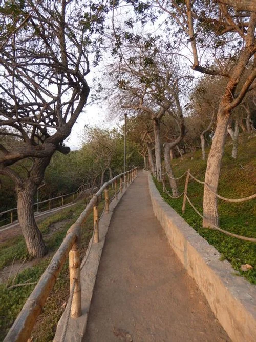
Since Parque Ecológico Loma Amarilla is only about 500m x 150m in size, it’s worth exploring every last inch of the park’s paths. The main path takes you gently up to an encased statue of the Virgin Mary and offers views out to the east towards the communities of Villa María. Viewpoints are so few and far between in Lima that it’s great to be able to run somewhere with some elevation. Descend your choice of steps or narrow paths to drop back down to a path that runs parallel to the main road to create a loop around the park. You can also create mini-loops in other areas of the park.
Aside from the hill training opportunities provided by the park’s inclines of the paths, you might want to combine your running with some callisthenics due to the abundance of callisthenic bars and outdoor workstations dotted around the park.
The park is open 24 hours a day, but as with any city park, be cautious late at night. The busy wide path through the heart of the park up to the summit is well-lit; the paths leading off it are less so.
The parks of San Borja
A stretch of Avenida San Borja Norte
I’ve not run through San Borja, but there is a series of seemingly interconnected parks and pathways that form various loops around one of the nicer districts of Lima. Zoomed-out satellite map images suggest a series of canals that run through San Borja, but really, this is just the way parks and green spaces have been squeezed in between main roads. Incidentally, there is a canal* that flows north-south through San Borja. These parks and green spaces do make for obvious running routes but expect lots of road crossings.
*Río Surco is the name of the canal created from the Río Rímac that has been diverted through the southern districts of Lima to irrigate parks.
San Borja gives you the chance to get off the concrete
The Pentagonito running loop
Perhaps the most popular running route in San Borja is the loop around what is colloquially known as the Pentagonito, or “Little Pentagon,” owing to it being the headquarters of the Peruvian Army.
The running route is actually a six-sided pentagon (!) but measures approximately 2.5 miles (4 km) in length.
On Sundays (6am-1pm), Muévete San Borja sees all the roads surrounding the Pentagonito closed to traffic, creating an even more enjoyable running experience. What’s more, there are various sports and exercise stations - table tennis and dance classes, for example - positioned around the Pentagonito.
The 2.5-mile running loop in southwest San Borja known as El Pentagonito
Do you have anything to add to these running locations?
Where else do you like to run in Lima?
What sport do you want to play?


